Space Missions
Earth Remote Sensing via GNSS Radio Occultation (EARS)
The EARS mission will develop a LEO satellite constellation with the capability to determine parameters of the Earth’s atmosphere with high vertical resolution and low latency using the GNSS RO technique. The mission will utilize powerful System-On-Chip (SoC) and advanced precise orbit determination (POD) algorithm which will allow processing of the data directly on-board. Downlinking only the information, which is useful to the end user, will severely decrease necessary data-link throughput -> allowing to build a dense network of simple ground stations and reducing latency to < 30 minutes.

On-orbit processing
One of the key developments will be the POD module providing relative velocity accuracy up to ~ 0.1 mm/s for LEO satellites – sufficient to allow on-orbit processing of the RO data. The lack of this capability is currently preventing other operational RO providers from processing their data on-orbit. This will give us the edge in reducing demands on valuable data-link bandwidth. As a result, we will be able to offer our customers access to much more data and/or reduced latency - effectively moving their applications directly into orbit.
The initial satellite will demonstrate this capability for RO data (potentially including polarized RO). However, future satellites will extend these benefits to additional techniques (GNSS-R, SAR, InSAR) leveraging the mission’s potential to provide customers with unprecedented data volumes.
Also, the POD module will be offered as a separate product to satellite developers. We envision potential applications in the areas of satellite monitoring for collision avoidance, maneuver planning and automation, LEO PNT and others.
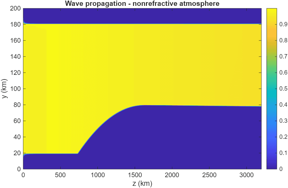
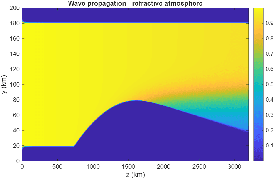
GNSS Radio Occultation
GNSS Radio occultation is remote sensing application used for determining atmospheric parameters. It relies on the fact that the Earth’s atmosphere is refractive -> electromagnetic rays (like those emitted from GNSS satellites at MEO) are bent when passing through (as illustrated on the images below). This bending, which is observable as an additional Doppler shift on the receiving LEO satellite, holds information about temperature, pressure, humidity… As such, these measurements are valuable to numerical weather prediction models. Being used for prediction, ensuring low latency (measurement to model integration) of the data is crucial, even more with emerging techniques like nowcasting.
Organization
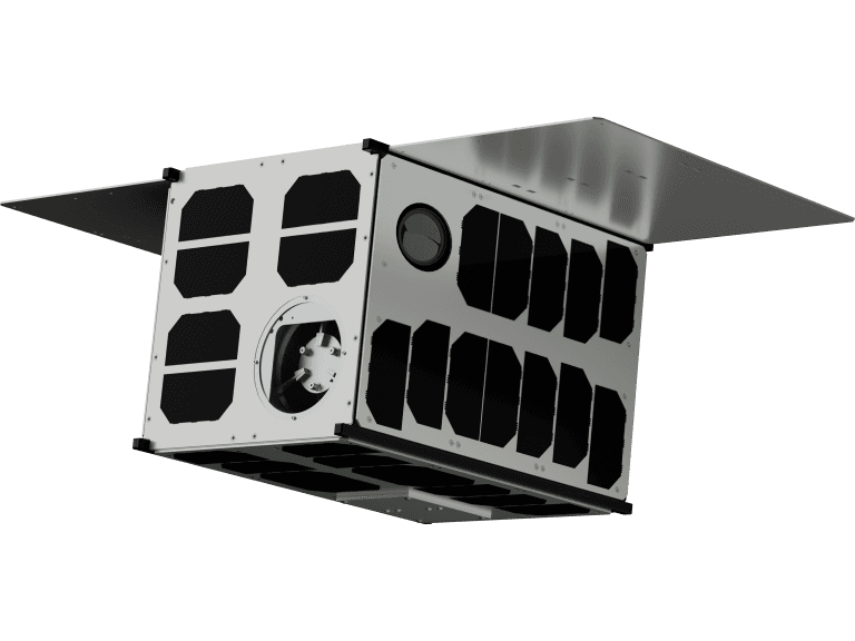
Stellar Exploration is the mission prime and developer of key technologies – POD module, multichannel receiver module, RO processing algorithms... The cubesat satellite bus will be provided by Spacemanic CZ and the ground segment will be developed by Groundcom – both czech SMEs with relevant experience in their fields.
The mission is supported from ESA’s InCubed program.